
EN
EN
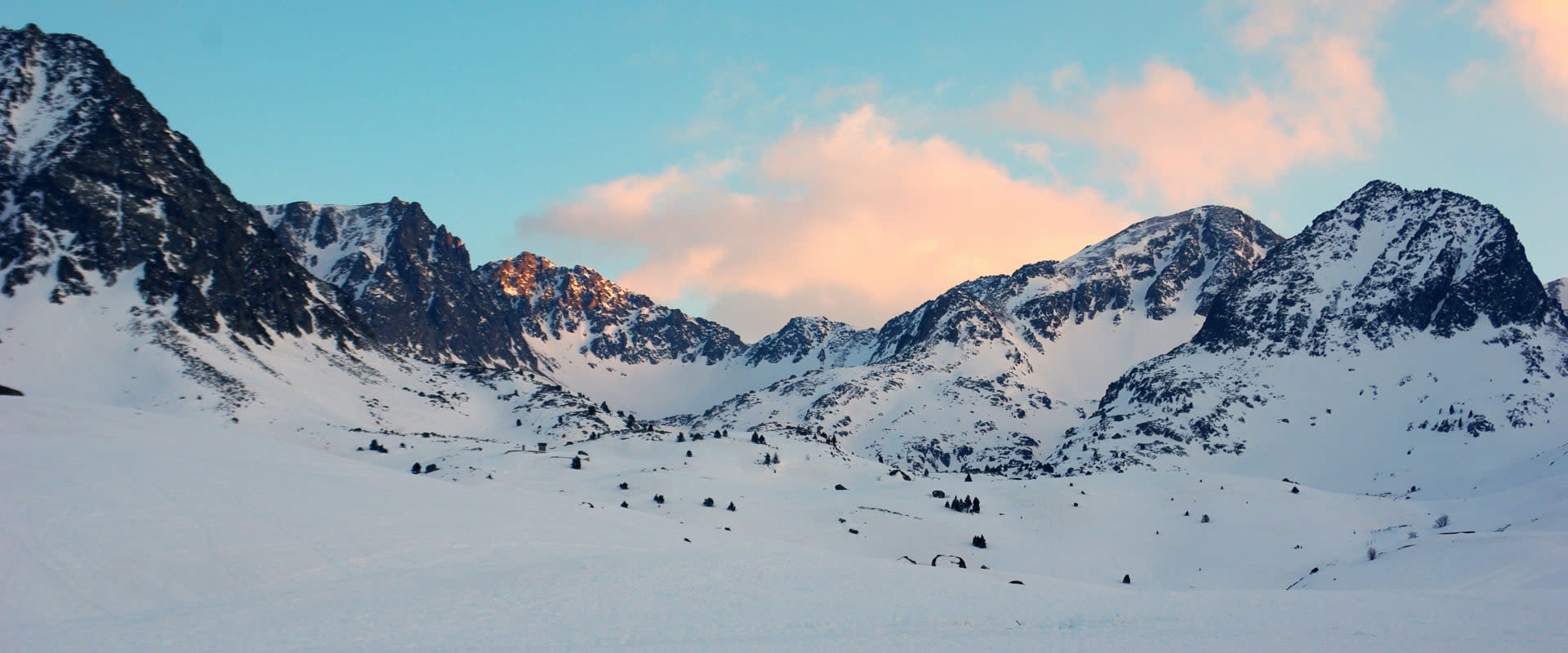
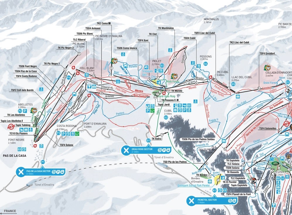
The eastern end of Grandvalira: the slopes above Pas de la Casa itself and the Grau Roig bowl over the ridge behind it. The Grandvalira pass covers these and carries you west along the whole chain to Soldeu, El Tarter, Canillo and Encamp.
Pal Arinsal and Ordino-Arcalís are on the other side of Andorra, on a different pass, and not on this map.
Pas de la Casa ski resort guide · Grandvalira
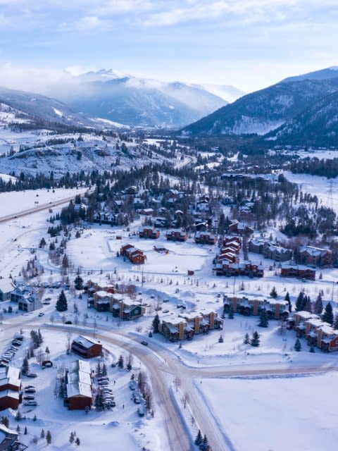
Two bowls back to back with a ridge between them, and the village sitting in the eastern one at 2,050 m, pressed up against the French frontier. That altitude is the thing to read off this sheet: the village is higher than the top of several Scottish mountains, the runs start at the door, and the snow record is the best in the principality. The flip side is exposure — there is almost nothing here that is not above the treeline, so when the weather closes in there is nowhere sheltered to go, and the answer is to head west down the chain.
GreenBlueRedBlack100 km at this end, 210 km across Grandvalira, 31 lifts, 2,050 m to 2,640 m
Runs falling straight into the village from three sides, almost all of them blue and red, with ski-in ski-out from most of the accommodation. The French frontier runs along the top of the eastern lifts.
It is the busiest ground on this sheet and the first to get tracked out after a snowfall, simply because everyone staying here starts on it.
A bowl with no real village in it, reached over the top from Pas or by road, and noticeably calmer. It faces differently and sits lower in the wind, which makes it the place to be when the Pas side is being scoured.
It also holds the best of the area's off-piste and the route west along the chain towards Soldeu.
Workable, and the snow is reliable, but this is the least gentle end of Grandvalira — the terrain is open and exposed and there is little true green. Soldeu or Pas de la Casa is worth reading before you book a first trip.
Strong. Ski out of the door onto decent snow, and when you want more, the whole chain runs west — the full Grandvalira map is a proper day's travelling in each direction.
The steepest marked runs in Grandvalira are here and in Grau Roig, and after a storm the off-piste on the French side of the ridge is the best in the country. It is still a modest offer by Alpine standards.
West along the chain on the same pass, lower and more sheltered, with the ski schools that most of Grandvalira's reputation rests on.
The next gateway along, with its own gondola into the middle of the map and a quieter, more family-oriented village.
The low western end of the chain, furthest from this sheet, reached by the long Funicamp gondola from the valley floor.
Conditions before you go · Pas de la Casa webcam
Package holidays to Pas de la Casa with flights, transfers, accommodation and lift pass, all booked together.
See Pas de la Casa ski holidays



WeSki is a trading name operated by Wetrip Weski Ltd (BR021500). All the flights and flight-inclusive vacations on this website are financially protected by the ATOL scheme. When you pay you will be supplied with an ATOL Certificate. Please ask for it and check to ensure that everything you booked (flights, hotels and other services) is listed on it. Please see our booking conditions for further information or for more information about financial protection and the ATOL Certificate go to: www.caa.co.uk.
Package vacations that do not include travel by air are financially protected via ABTOT.
For the latest travel advice from the Foreign & Commonwealth Office visit www.gov.uk/foreign-travel-advice.
Weski Europe BV (Chamber of Commerce registration number 87334100) is a registered participant of SGR. You can verify this on www.sgr.nl/english. Vacations listed on this website are covered by SGR’s guarantee, within the terms of the SGR guarantee scheme. Under SGR’s guarantee, consumers shall have their prepaid travel sum refunded if their counterparty is unable to fulfill its contractual obligations due to financial inability. Insofar as the agreement includes the transport and the destination has already been reached, the return trip will be arranged.