
EN
EN
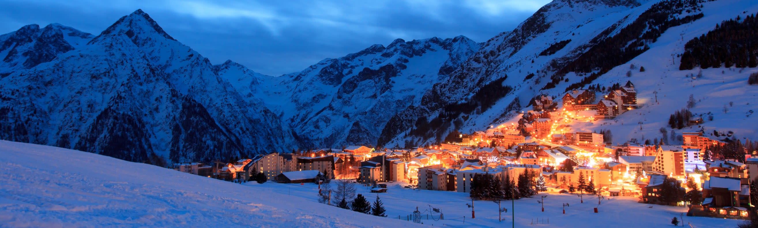
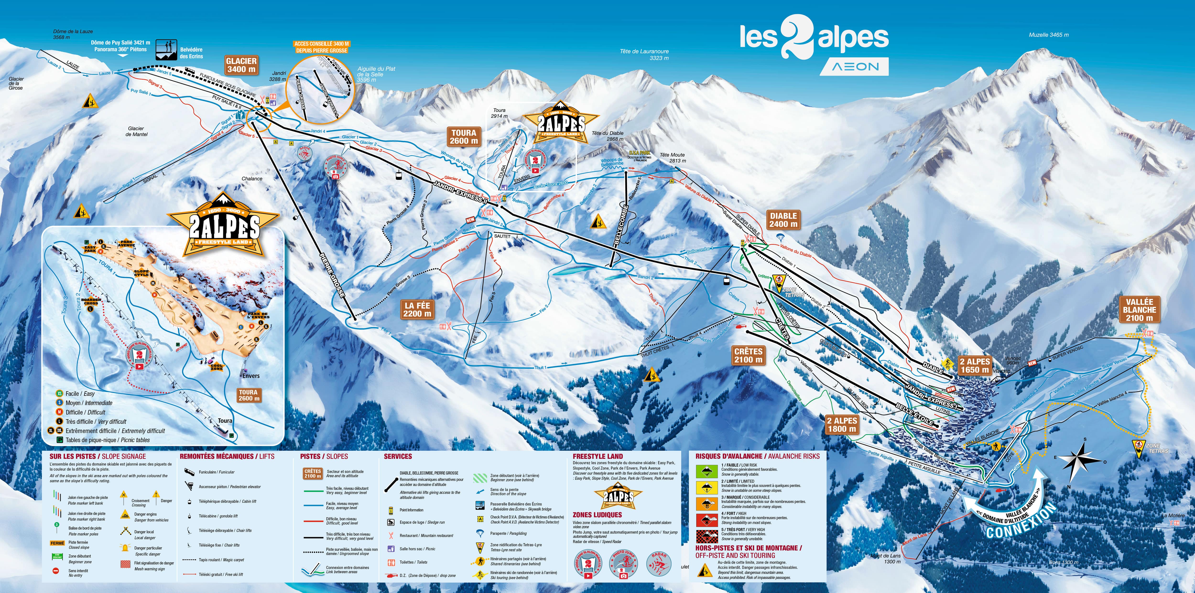
This sheet is the Les Deux Alpes ski area on its own: everything above the village, up the Jandri spine to the glacier, plus the smaller Pied Moutet slopes on the opposite side of the valley. One pass covers all of it.
What the sheet does not show is La Grave, over the back of the glacier. It is a separate mountain on a separate ticket, reached on a day trip rather than skied home from, so treat anything beyond the top of the map as a different trip entirely.
Les Deux Alpes ski resort guide · Ski resorts in France
Almost every resort map asks you to read across a valley. This one asks you to read up a wall. The village sits in a narrow trench at the bottom and a single chain of lifts climbs 2,300 m from it to the Dôme de la Lauze, with the sectors stacked one above the next like floors in a building. The consequence is worth knowing before you book: the wide, forgiving terrain is at the top, on the glacier, and the runs back down to the village are the steepest and the busiest on the sheet. Beginners here ride up, not down.
16 green46 blue16 red10 black88 runs, 43 lifts, 1,300 m to 3,600 m
The strip immediately above the village, and where most of the week's traffic sits. Les Crêtes at 2,100 m is the broad shelf the ski schools work from, with free button lifts and gentle greens and blues, so it is the sector to aim for while you are still finding your feet rather than the runs below it.
Everything funnels back through here at four o'clock. If you want to avoid that, drop into the village early or ride the Jandri down.
Diable sits on the left of the sheet as you look up and holds the sector's reds; Vallée Blanche is the broad, open bowl off to the right, which stays noticeably emptier and has the longer views back over the valley to La Muzelle.
These are the two sectors to use when the main Jandri corridor is queueing, and the pair that make the mid-mountain worth more than a transit zone.
The dense band of red and black lines in the centre of the map. This is where the pitch is, and where the serious skiing on the main mountain happens — long sustained descents rather than short pitches, with the mogul fields off the Fée chair.
It is also the band you have to cross to get from the glacier back to the village, which catches out groups who come up on the Jandri and discover the way down is harder than the way up.
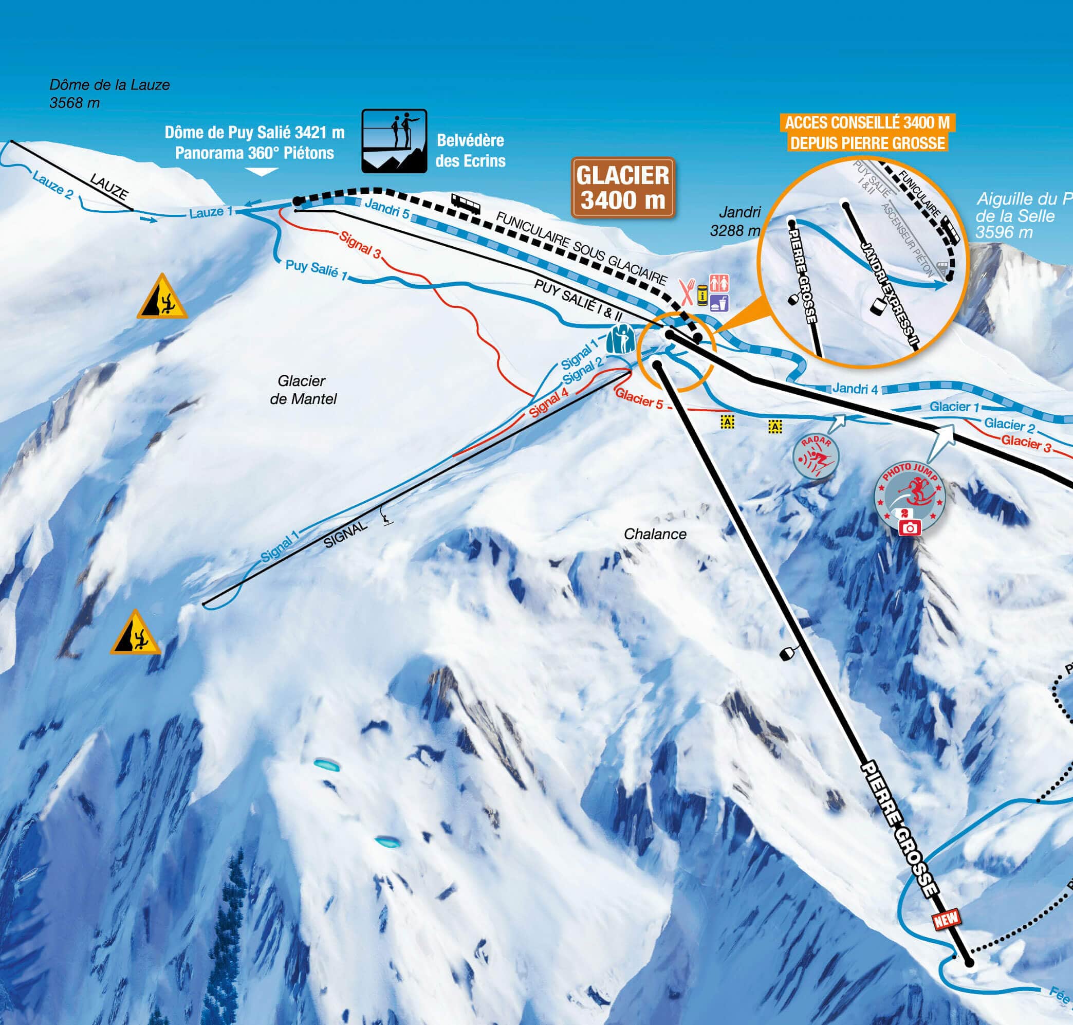
The highest skiable ground in France, and the reason the resort holds snow when its neighbours do not. The runs up here are wide, gentle and almost entirely green and blue, which is the inversion that makes this map unusual: the easiest skiing on the sheet is the hardest to reach.
It also opens for summer skiing long after the rest of the map shuts.
The small separate sector on the opposite side of the valley, and the only part of the map with trees worth the name. It faces the main mountain, so it catches the afternoon sun and gives you something to ski when flat light shuts the glacier down.
Easy to ignore on the sheet because it sits apart from the main spine, which is precisely why it is usually empty.
Les Crêtes at 2,100 m first, then the glacier once you can ride a chair confidently — the greens up there are as gentle as anything in France. The thing to understand is that you will be riding lifts down as well as up for the first few days, because the runs back into the village are not beginner terrain. Worth reading Alpe d'Huez or Les Deux Alpes before you commit if it is a first trip.
The sweet spot here. Vallée Blanche and Diable give you quiet blues and reds at mid-mountain, and the full-length descent from 3,600 m to the village is 2,300 m of vertical in one go — one of the longest continuous runs in the Alps, and worth planning a morning around rather than stumbling into.
Toura and La Fée hold the marked blacks and the mogul fields. Beyond the pistes, the glacier is the gateway to serious off-piste descents towards La Grave and down the Chalance and Diable couloirs — glaciated terrain, crevassed, and not somewhere to go without a guide.
Forty minutes round the valley and the obvious alternative: a sprawling sunny area that reads left to right across a mountainside, where this one reads straight up.
Over the Col du Lautaret on a separate pass, and a completely different proposition — tree skiing spread along a valley floor rather than one high wall.
On the Alpe d'Huez side of the valley and the quieter way into that area, if the scale of this sheet appeals but the crowds on the Jandri do not.
Package holidays to Les Deux Alpes with flights, transfers, accommodation and lift pass, all booked together.
See Les Deux Alpes ski holidays



WeSki is a trading name operated by Wetrip Weski Ltd (BR021500). All the flights and flight-inclusive vacations on this website are financially protected by the ATOL scheme. When you pay you will be supplied with an ATOL Certificate. Please ask for it and check to ensure that everything you booked (flights, hotels and other services) is listed on it. Please see our booking conditions for further information or for more information about financial protection and the ATOL Certificate go to: www.caa.co.uk.
Package vacations that do not include travel by air are financially protected via ABTOT.
For the latest travel advice from the Foreign & Commonwealth Office visit www.gov.uk/foreign-travel-advice.
Weski Europe BV (Chamber of Commerce registration number 87334100) is a registered participant of SGR. You can verify this on www.sgr.nl/english. Vacations listed on this website are covered by SGR’s guarantee, within the terms of the SGR guarantee scheme. Under SGR’s guarantee, consumers shall have their prepaid travel sum refunded if their counterparty is unable to fulfill its contractual obligations due to financial inability. Insofar as the agreement includes the transport and the destination has already been reached, the return trip will be arranged.