
EN
EN
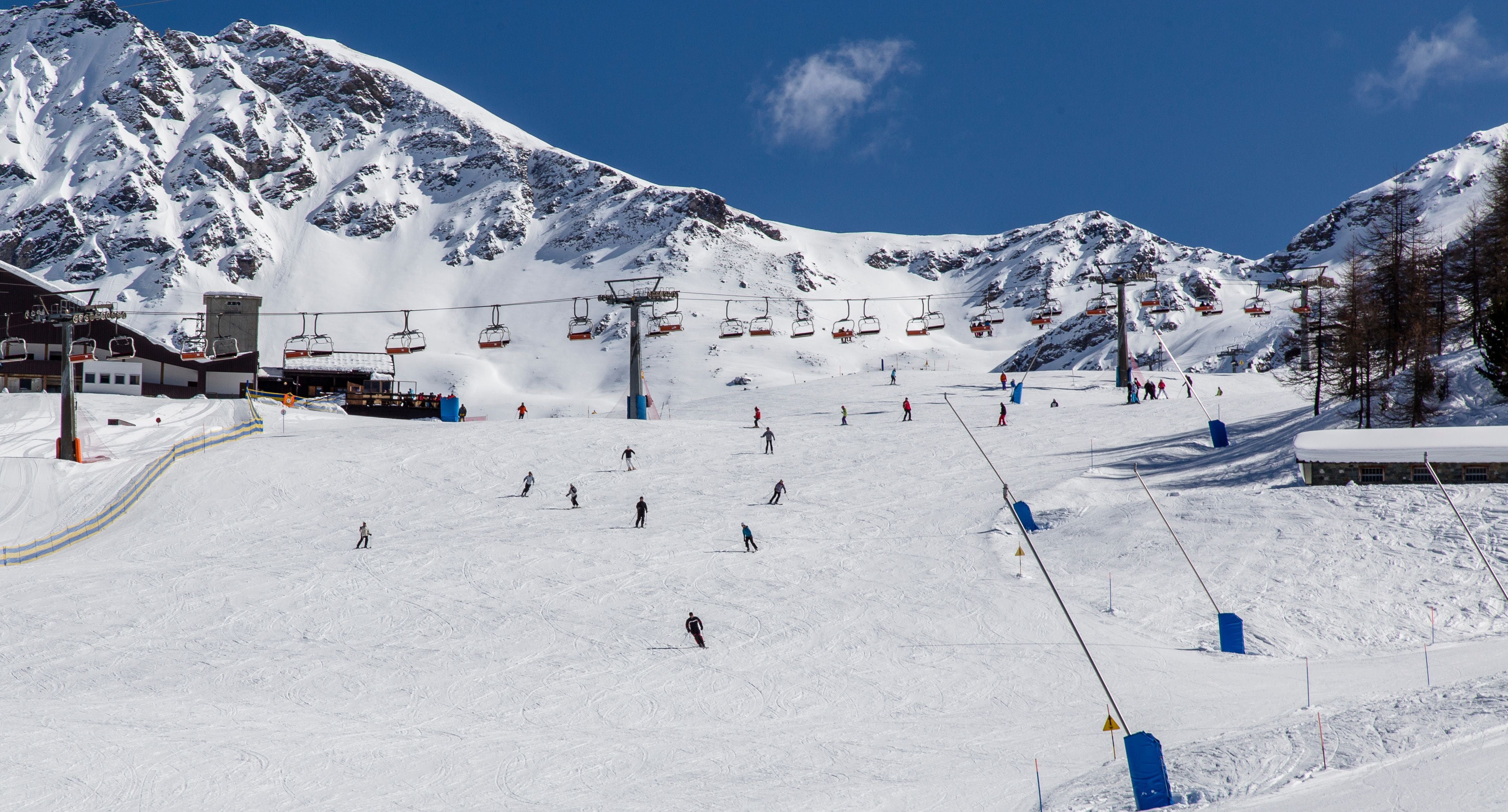
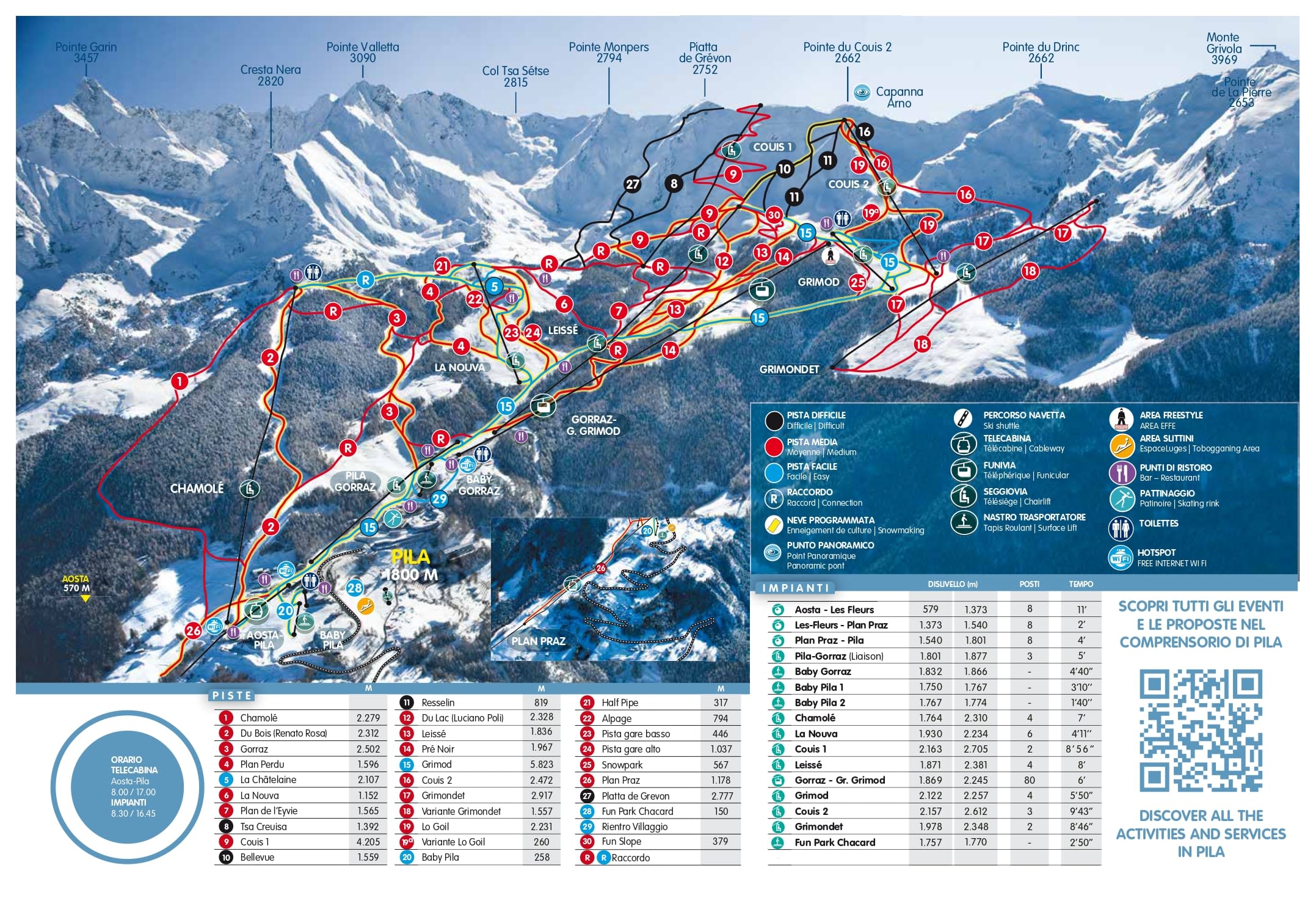
The whole Pila ski area on one sheet, from the village at 1,800 m up to Couis 1 at 2,700 m, all on a single local pass.
Aosta appears at the bottom of the map but there is no piste down to it — the Aosta-Pila cable car is the link, and it runs from beside the railway station. The wider Aosta Valley pass adds Courmayeur, Cervinia and La Thuile, none of which are on this sheet.
Pila ski resort guide · Ski resorts in Italy
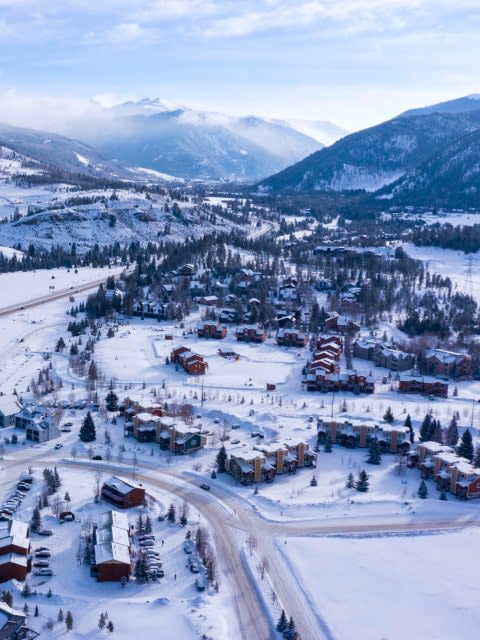
Pila is a single south-facing bowl with the village sitting in the middle of it, which makes this one of the easiest maps in the Alps to read: almost everything comes back to the same place, and from the village you can see most of where you have been. The runs fan out above and below it, with tree-lined pistes on the lower half and open ground above 2,300 m. There is no second valley, no link to anywhere else and nothing to get lost in, which is exactly why families end up here.
GreenBlueRedBlack14 lifts, 1,800 m to 2,700 m, with the Aosta cable car dropping to 583 m
The middle of the map and the hub of the week. The nursery area and the ski school sit right by the beds, and the runs back to the village from every direction are blue.
Because everything funnels here, it is also where you will spend your lift queues — though by Alpine standards there barely are any.
Above the trees, with the small lake under it and the best spread of red runs on the sheet. This is where the mountain gets interesting once you are past the village slopes.
It is also the gateway to the top. Nothing above here runs without the Chamolé chair, so watch it in wind.
The summit ridge, the Mont Blanc view that Pila is sold on, and the start of the long descent back through the whole map — around 1,000 m of vertical in one go.
It is also the access point for Pila's off-piste, which is the resort's real secret and far better than its gentle reputation implies.
Unusually good. The gentle ground is right by the accommodation rather than a lift ride away, the bowl is easy to understand, and the slopes are quiet enough that a nervous first-timer is not dodging traffic.
A comfortable rather than a challenging week. The Chamolé reds and the full descent from Couis are the best of it, and the sunshine is a real part of the appeal. If you want more mileage, the Aosta Valley pass puts Courmayeur and Cervinia within reach by road.
Thin on marked blacks, but the off-piste off the Couis ridge and down the Chamolé flanks is genuinely good and rarely tracked. Go with a guide and the mountain is considerably better than the piste map makes it look.
Forty minutes up the Aosta valley on a separate ticket, or on the valley-wide pass — steeper, more fashionable, and with a proper town at the bottom.
The other end of the Aosta valley and the high-altitude option, with the link over to Zermatt on the international pass.
Past Courmayeur and over towards the French border, linked across to La Rosière and much quieter than either.
Package holidays to Pila with flights, transfers, accommodation and lift pass, all booked together.
See Pila ski holidays



WeSki is a trading name operated by Wetrip Weski Ltd (BR021500). All the flights and flight-inclusive vacations on this website are financially protected by the ATOL scheme. When you pay you will be supplied with an ATOL Certificate. Please ask for it and check to ensure that everything you booked (flights, hotels and other services) is listed on it. Please see our booking conditions for further information or for more information about financial protection and the ATOL Certificate go to: www.caa.co.uk.
Package vacations that do not include travel by air are financially protected via ABTOT.
For the latest travel advice from the Foreign & Commonwealth Office visit www.gov.uk/foreign-travel-advice.
Weski Europe BV (Chamber of Commerce registration number 87334100) is a registered participant of SGR. You can verify this on www.sgr.nl/english. Vacations listed on this website are covered by SGR’s guarantee, within the terms of the SGR guarantee scheme. Under SGR’s guarantee, consumers shall have their prepaid travel sum refunded if their counterparty is unable to fulfill its contractual obligations due to financial inability. Insofar as the agreement includes the transport and the destination has already been reached, the return trip will be arranged.